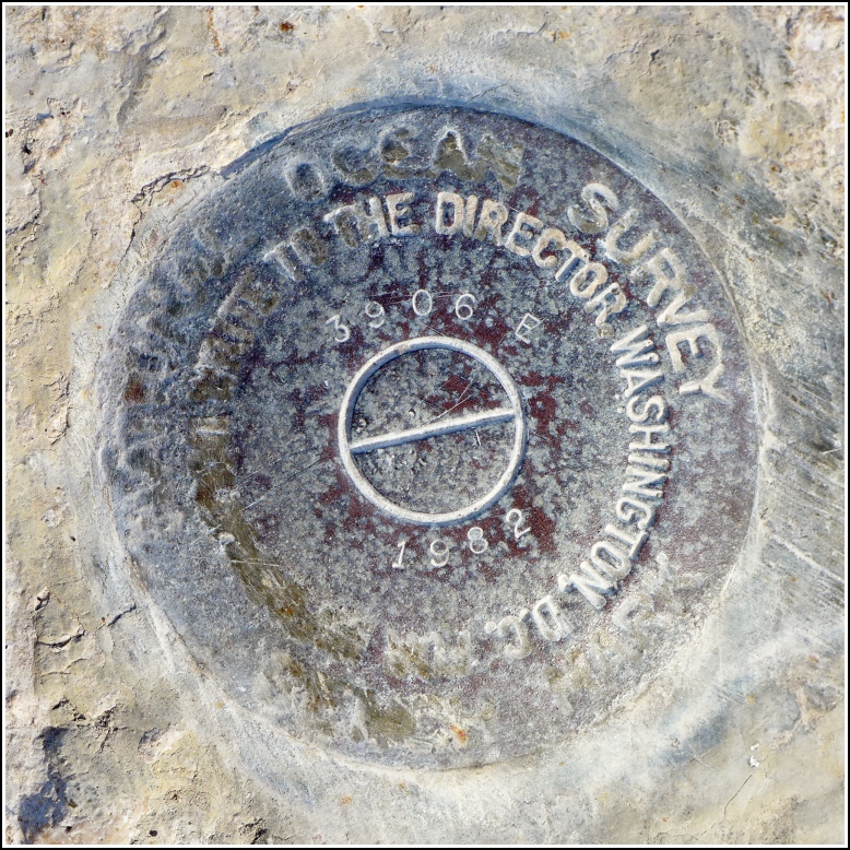
872 3906 E TIDAL (AA1721)
872 3906 E TIDAL
Recovered in Good Condition on February 22, 2016
Spatial/elevation data
| Coordinates | N 24.791045° W 80.884151° |
| Elevation | 12.20 ft. |
| Location | Florida
Monroe County Grassy Key Quad |
Mark description
| Type | Tidal Bench Mark Disk |
| Setting | Bridge Wingwall |
| Monumented | 1982 by Florida Dept. of Natural Resources |
| Description (NGS) | NGS Datasheet |
NGS recovery information
Descriptive text
Recovered in good condition. The mark is located on the south wingwall at the western end of the old Long Key Viaduct, which is now a fishing pier and part of the Florida Keys Overseas Heritage Trail. The current U.S. Route 1 bridge is directly north of the old bridge.Narrative and photographs
One of three marks we found at the western end of the Long Key Viaduct, 872 3906 E TIDAL is set into the southwest wingwall of the old highway bridge, which is now a fishing pier and part of the Florida Keys Overseas Heritage Trail. The disk is in good condition. It can be accessed by parking in the lot for the fishing pier and trail and walking east toward the old bridge.


