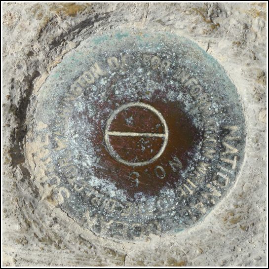
872 4557 TIDAL 5 (AA0917)
872 4557 TIDAL 5
Recovered in Good Condition on February 23, 2014
Spatial/elevation data
| Coordinates | N 24.546633° W 81.784133° |
| Elevation | 2.67 ft. |
| Location | Florida
Monroe County Key West Quad |
Mark description
| Type | Tidal Bench Mark Disk |
| Setting | Concrete Sidewalk |
| Monumented | 1974 by National Ocean Service |
| Description (NGS) | NGS Datasheet |
NGS recovery information
Descriptive text
Recovered in good condition. The mark is set in the curb at the far western edge of the pier. The light poles have changed since the original description was written. The disk is northwest of the third light pole, counting from the north end of the pier.Narrative and photographs
This was another relatively easy find on the White Street Pier. We were a little misled at first by the Power Squadron recovery note from 2003; it seems that they may have mixed this one up with 872 4557 TIDAL 4, which does appear to be missing. (At least we couldn’t find it, and neither could a geocacher a few years ago.) But this one is easy to find once you realize that the light poles must have changed since the original description was written. The disk is northwest of the third light pole (rather than the first), counting from the north end of the pier.

