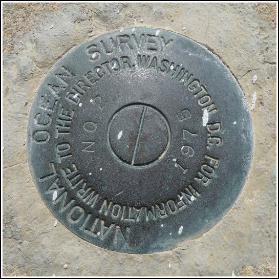
872 3868 TIDAL 2 (AA0806)
872 3868 TIDAL 2
Recovered in Good Condition on February 18, 2014
Spatial/elevation data
| Coordinates | N 24.8448° W 80.748033° |
| Elevation | 17.33 ft. |
| Location | Florida
Monroe County Lower Matecumbe Key Quad |
Mark description
| Type | Tidal Bench Mark Disk |
| Setting | Bridge Abutment |
| Monumented | 1975 by National Ocean Service |
| Description (NGS) | NGS Datasheet |
NGS recovery information
Descriptive text
Recovered in good condition.Narrative and photographs
We spent our morning getting acquainted with Islamorada. We searched for a few benchmarks in Founders’ Park, walked some sections of the Heritage Trail, and drove up and down the highway, checking out the sights and stopping here and there to check the bridges for benchmarks. This was one of them. This mark is set on a curb of the old bridge over Channel #2. It is in good condition. The old bridge is the more northerly of the two and is now used for hiking, biking, and fishing.

