M 69 RESET (AA0389)
M 69 RESET
Spatial/elevation data
| Coordinates | N 24.839448° W 80.780073° |
| Elevation | 14.69 ft. |
| Location | Florida
Monroe County Long Key Quad |
Mark description
| Type | Tidal Bench Mark Disk |
| Setting | Bridge Wingwall |
| Monumented | 1936 by NGS |
| Description (NGS) | NGS Datasheet |
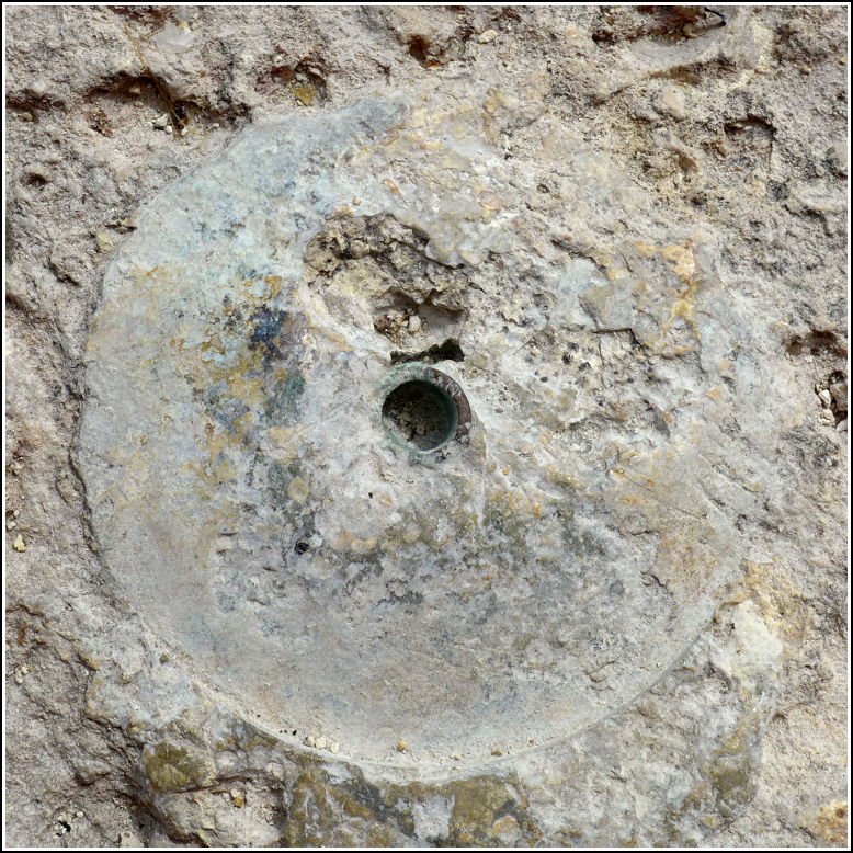
Narrative and photographs
While on a leisurely benchmark hunting spree on Long Key’s fishing piers, we found what we have deduced to be the remains of two missing disks: M 69 and M 69 RESET. They are both set into the same wingwall: the southwest wingwall of the old U.S. Route 1 bridge at the western end of the bridge over Channel 5. This is an interesting area because the southwest wingwall of the old bridge actually passes beneath the new bridge. This mark, M 69 RESET, was somewhat further down the wingwall than the original M 69, which is at the very top, actually butting right up against the bridge deck (which was probably extended a bit after the mark was placed) and within a few inches of 872 3872 G TIDAL (AA1727). Now all that remains of both is less than a centimeter of the stem, and a slight impression of the edges of the disk in the concrete surrounding the stem.
