V 278 (AA0289)
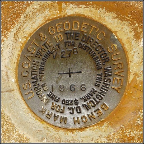
V 278
Spatial/elevation data
| Coordinates | N 24.70435° W 81.15595° |
| Elevation | 26.26 ft. |
| Location | Florida
Monroe County Sevenmile Bridge Quad |
Mark description
| Type | Bench Mark Disk |
| Setting | Concrete Berm |
| Monumented | 1966 by NGS |
| Description (NGS) | NGS Datasheet |
NGS recovery information
Descriptive text
Recovered in good condition on Old Seven Mile Bridge. The mark is directly north of a ramp leading down to Pigeon Key.Narrative and photographs
V 278 was a surprise find along the Old Seven Mile Bridge. Our passage to Pigeon Key this morning was by ferry. After a thorough tour of the island an our own unofficial explorations (and searches for three other survey markers), Rich and I walked Old Seven Mile Bridge back to our starting point on Knight Key, a stroll of about two miles. We had planned to keep an eye out for marks along the bridge, but didn’t have any particular marks in mind until we actually reached Knight Key. But as soon as we reached the top of the wooden ramp leading from Pigeon Key to Old Seven, there was V 278 staring us right in the face!
The disk is in excellent condition just north of the wooden ramp to Pigeon Key and just east of the end of the passable section of the Old Seven Mile Bridge.


