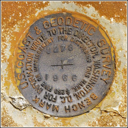
U 278 (AA0296)
U 278
Recovered in Good Condition on February 19, 2014
Spatial/elevation data
| Coordinates | N 24.70595° W 81.138483° |
| Elevation | 29.61 ft. |
| Location | Florida
Monroe County Sevenmile Bridge Quad |
Mark description
| Type | Bench Mark Disk |
| Setting | Concrete Berm |
| Monumented | 1966 by NGS |
| Description (NGS) | NGS Datasheet |
NGS recovery information
Descriptive text
Recovered in good condition on Old Seven Mile Bridge as described.Narrative and photographs
Continuing our stroll eastward along Old Seven Mile Bridge, Rich spotted U 278, the next mark in the line after V 278. This disk is also in very good condition and is set in the north curb of the bridge. The two mile walk from Pigeon Key back to Knights Key offers plenty of time to reflect on the engineering marvel of the bridge, and the fact that this extremely narrow span once carried a two-lane highway!

