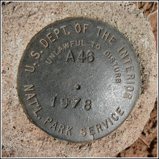
A 46
A 46
Recovered in Good Condition on September 15, 2008
Spatial/elevation data
| Coordinates | N 37.165083° W 108.48765° |
| Elevation | Unknown |
| Location | Colorado
Montezuma County Moccasin Mesa Quad |
Mark description
| Type | Survey Mark |
| Setting | Round Concrete Monument |
| Monumented | 1978 by National Park Service |
| Description (National Park Service) | Unavailable. |
Narrative and photographs
We unexpectedly found this National Park Service survey marker while driving the Mesa Top Loop in Mesa Verde National Park. The disk is set in a tall concrete post projecting about 2 feet above the ground, so you really couldn’t miss it. It is just off the road near one of the excavated pithouses. The disk is in excellent condition. I wish we could find a source for descriptions of these marks!


