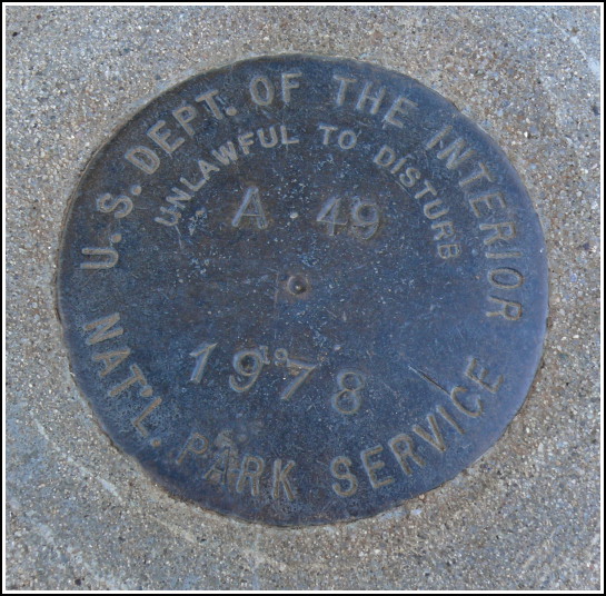
A 49
A 49
Recovered in Good Condition on September 15, 2008
Spatial/elevation data
| Coordinates | N 37.165267° W 108.487667° |
| Elevation | Unknown |
| Location | Colorado
Montezuma County Moccasin Mesa Quad |
Mark description
| Type | Survey Mark |
| Setting | Round Concrete Monument |
| Monumented | 1978 by National Park Service |
| Description (National Park Service) | Unavailable. |
Narrative and photographs
Like A 46 nearby, we found this disk unexpectedly while driving the Mesa Top Loop in Mesa Verde National Park. This is in a more standard round concrete monument close to the surface of the ground, unlike the high monument that A 46 is set into. Still, it was in close proximity to the sidewalk leading toward the pithouses, and was easy for us to spot. Given that there are two markers so close together, I suspect there are more, perhaps set around the pithouses for use in some archaeological projects. The disk and monument appear to be in very good condition.


