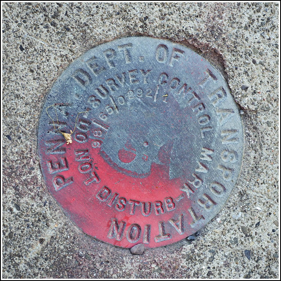
98-65-0292-1
98-65-0292-1
Recovered in Good Condition on May 6, 2023
Spatial/elevation data
| Coordinates | N 41.472458° W 76.002013° |
| Elevation | Unknown |
| Location | Pennsylvania
Wyoming County Noxen Quad |
Mark description
| Type | Survey Control Mark |
| Setting | Bridge Wingwall |
| Monumented | 1998 by PennDOT |
| Description (PennDOT) | Unavailable. |
Narrative and photographs
This PennDOT mark was what I found in place of the 1942 USGS bench mark disk (38 B) that I had hoped to find in this location. The bridge is obviously much newer than 1942, so it wasn’t too surprising. This mark is set in the west wingwall, just as the USGS mark was. It is in good condition. As we have noted from previous stamped PennDOT marks, the designation indicates the year (1998), the county (65: Wyoming County), the route number (SR 0292), and the number of the mark on that route or line.

