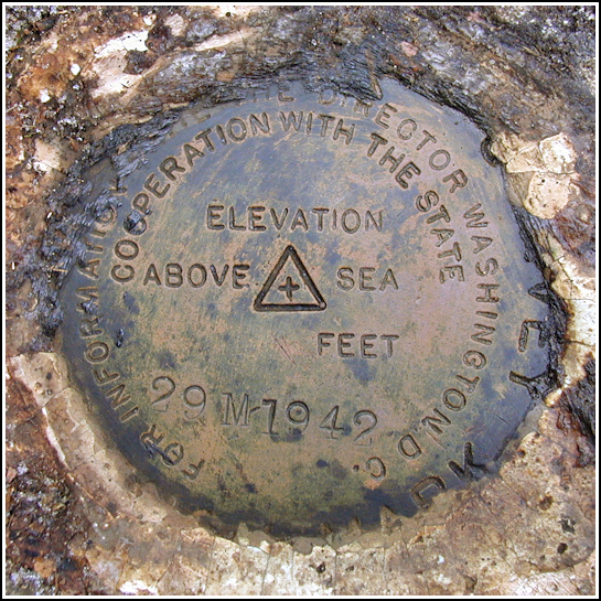
29 M
29 M
Recovered in Good Condition on December 30, 2004
Spatial/elevation data
| Coordinates | N 41.66925° W 75.29225° |
| Elevation | 1080.615 ft. |
| Location | Pennsylvania
Wayne County Honesdale Quad |
Mark description
| Type | Bench Mark Disk |
| Setting | Boulder |
| Monumented | 1942 by USGS |
| Description (USGS) | Tanners Falls, 1.2 mi N. of, along rd. up W. side of East Branch; 150 ft S. of small brook; 80 ft W. of rd.; in boulder; standard tablet stamped “29 M 1942”. Elev. 1080.615 ft. Reference mark; 60 ft N. of tablet; 90 ft W. of rd,; on boulder; chiseled square. Elev. 1076.57 ft. |
USGS recovery information
View reportNarrative and photographs
After finding Tanners’ Condos and chiseled square 1102.46 nearby, we left the gamelands at Tanners Falls and traveled north along Upper Woods Road to approach the coordinates I’d approximated from the map for this mark. We were pleased to find a convenient SGL parking area directly adjacent to the mark! Once we stepped into the woods the location of the mark was immediately apparent. The trees surrounding the boulder were blazed with pink paint and/or encircled with pink flagging tape. The disk required some cleaning, but was otherwise in fine condition. The stamping is light, but legible. All measurements match those in the description. We did not search for the reference mark at this time.


. The pink blaze on the tree makes the mark's location obvious.")