1102.46
Recovered in Good Condition on December 30, 2004
Spatial/elevation data
| Coordinates | N 41.6632° W 75.29798° |
| Elevation | 1102.46 ft. |
| Location | Pennsylvania
Wayne County Honesdale Quad |
Mark description
| Type | Chiseled Square |
| Setting | Bridge Pier |
| Monumented | Unknown by USGS |
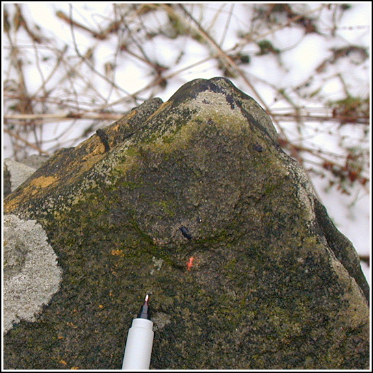
| Description (USGS) | U.E., Tanners Falls; on NE. corner of W. pier of steel bridge; square painted yellow (probably State BM). Elev. 1102.46 ft. |
USGS recovery information
View reportNarrative and photographs
Rich and I nearly missed this mark altogether. After a day of hunting and hiking in the gamelands and finding the Tanners’ Condos geocache, we looked through our USGS datasheets and found two nearby disks (29 M and 30 M) that we planned to investigate. It was only by accident that I happened to notice this “U.E.” listed, and we realized the mark had to be located on the bridge over the falls, which we’d just crossed twice. True to the description, a chiseled square was found on the northeast corner of the west pier of the bridge. Yellow paint is still evident along the side (north face) of the stone with the chiseled mark; currently there is no paint on the mark itself.


.")