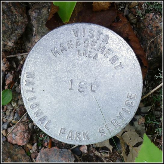
19 L
19 L
Spatial/elevation data
| Coordinates | N 44.336467° W 68.251017° |
| Elevation | Unknown |
| Location | Maine
Hancock County Southwest Harbor Quad |
Mark description
| Type | Vista Management Area Disk |
| Setting | Steel Rod |
| Monumented | Unknown by National Park Service |
Narrative and photographs
We came across this disk, and another related one nearby, after locating the lower portion of the abandoned Goat Trail near Jordan Pond. While we were counting coping stones on our way back to the Bubble Rock parking area as another way (in addition to GPS) of locating the handrail down to the old trail, we spotted these disks. They are labeled “Vista Management Area” and afterward, in looking for information on what this might mean, we found a report (linked below) about the purpose of these disks and the locations of many others on the island.
For more information about this disk, see: Vista Management Plan for the Historic Motor Road System, Acadia National Park: Vista 19.
Note: the full Vista Management Report is available here: NPS DataStore download. It is a very large file (464MB) that is slow to download.


