16718-10
16718-10
Recovered in Good Condition on September 8, 2013
Spatial/elevation data
| Coordinates | N 44.295917° W 68.242667° |
| Elevation | Unknown |
| Location | Maine
Hancock County Seal Harbor Quad |
Mark description
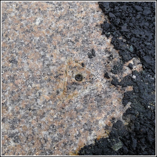
| Type | Drill Hole |
| Setting | Granite Foundation |
| Monumented | 2012 by MaineDOT |
| Description (MaineDOT) | To reach from the junction of Steamboat Wharf Rd and Rte 3, head Westerly on Rte 3 for 0.18mi to the station on the left. The station is a drill hole with a chiseled triangle around it.. IT IS: 18.5’ SSE of CL; 4.6’ SSE of face of curb; 1.3’ NW of first cedar post; 2.3’ NNW of back of granite block. BK#381 |
Narrative and photographs
This drill hole could be challenging to find because it is small, blends in quite easily with the surrounding rock, and the triangle is shallowly chiseled. The to-reach and description are accurate and precise, however; once in the area we discovered that there were only two possible locations to check. The location of this mark is indicated by a painted “10” on the street, similar to what we found at 16718-11 nearby (although at that station, the entire designation was painted on the street).

