PTS 1 Y
PTS 1 Y
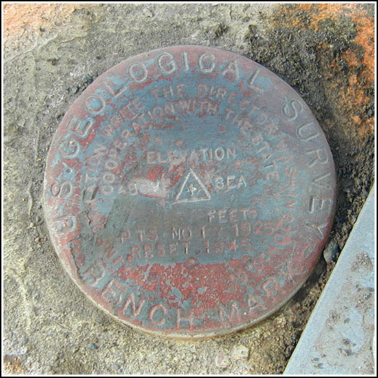
Recovered in Good Condition on February 7, 2005
Spatial/elevation data
| Coordinates | N 41.476066° W 75.17215° |
| Elevation | 896.021 ft. |
| Location | Pennsylvania
Wayne County Hawley Quad |
Mark description
| Type | Bench Mark Disk | ||||||
| Setting | Bridge Abutment | ||||||
| Monumented | 1925, reset 1945 by USGS | ||||||
| Description (USGS) | Hawley; near E. end of town; in SE. guardwall of E. abutment of steel hwy. bridge over Lackawaxen River; standard tablet stamped “PRIM TRAV STA NO 1 Y 1925 RESET 1945”. Elev. 896.021 ft.
|
USGS recovery information
View reportNarrative and photographs
PTS 1 Y is situated as described (the steel bridge has been replaced, but the old abutments remain), so it made for an easy find. It’s on the southeast corner of the east abutment of the Church Street bridge over the Lackawaxen River. Rich and I located it after finding Cat-in-the-hat’s Lackawaxen in Hawley - 1.1 cache in the park across the street. The disk has been painted over at least twice but the stamping is still legible and the disk is in good condition. The mark is just a few yards west of a USGS gaging station.

