10-63-2034-4
Spatial/elevation data
| Coordinates | N 41.501694° W 75.35125° |
| Elevation | Unknown |
| Location | Pennsylvania
Wayne County Honesdale Quad |
Mark description
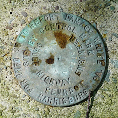
| Type | Survey Control Mark |
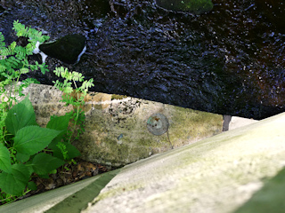
| Setting | Bridge Wingwall |
| Monumented | 2010? by PennDOT |
| Description (PennDOT) | Unavailable. |
Narrative and photographs
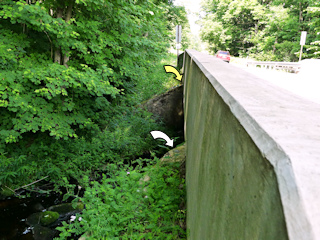
This was unexpected find #3 for today, and a very strange one because there is a USGS disk (47 DSW) on the same bridge. Both are located on the south side of the bridge; this PennDOT disk is on the southeast wingwall and 47 DSW is on the southwest wingwall. Our only guess for the reason was that 47 DSW is now only half-exposed (and difficult, if not impossible, to use as a control point) because at some point a new bridge deck was constructed on top of it. (See 47 DSW for a close-up photo.) This disk appears to be in good condition and is fully exposed.
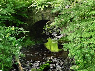
The real find here was the moss covered stone arch bridge half hidden in the woods just south of the highway bridge. It would fit in perfectly along Acadia’s carriage roads, but this was no Rockefeller bridge. We guessed—correctly, we later learned—that it was part of the Pennsylvania Coal Company’s gravity railroad running between Hawley and Pittston (not to be confused with the D&H Gravity Railroad that ran through Waymart). The PCC gravity preceded the nearby Erie & Wyoming Valley, mentioned in our notes for TT 9 J.


