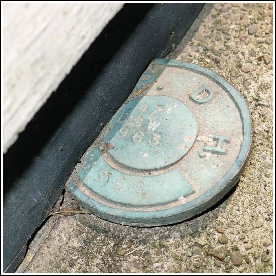
47 DSW
47 DSW
Recovered in Fair Condition on June 28, 2014
Spatial/elevation data
| Coordinates | N 41.501639° W 75.351277° |
| Elevation | 1207.381 ft. |
| Location | Pennsylvania
Wayne County Honesdale Quad |
Mark description
| Type | Elevation Mark |
| Setting | Bridge Wingwall |
| Monumented | 1963 by USGS |
| Description (USGS) | Gravity, about 2.9 mi NE. of, along dirt rd. leading to Middle Valley; 12 ft S. of, and about level with centerline of rd. opposite; in SE. corner of S. wingwall of steel bridge over large creek; PDH standard disk stamped “47 DSW 1963 USGS” |
Narrative and photographs
47 DSW was an unusual find! Not only was it one of two bench mark disks set on one bridge, but it is half-buried beneath the bridge decking. Perhaps because of this it is no longer usable, and that’s the reason why the second disk (a PennDOT mark) was set? We are really not sure. For now, we’re going to label its condition “Fair” due to the difficulty of actually taking observations on this mark.
This bridge is worth a visit for a reason other than the two bench mark disks: just to the south, and easily visible from the highway bridge, is a beautiful old stone bridge originally built by the Pennsylvania Coal Company gravity railroad.