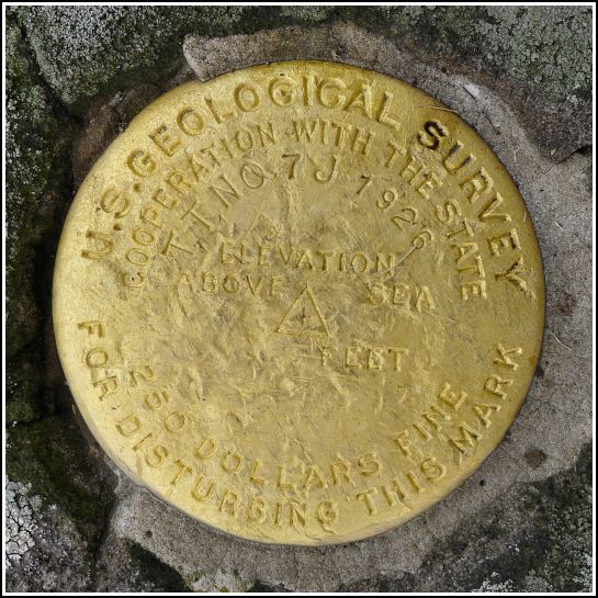
TT 7 J
TT 7 J
Recovered in Good Condition on October 5, 2013
Spatial/elevation data
| Coordinates | N 41.490283° W 75.398983° |
| Elevation | 1366.824 ft. |
| Location | Pennsylvania
Wayne County Lake Ariel Quad |
Mark description
| Type | Transit Traverse Station Disk |
| Setting | Rock Outcrop |
| Monumented | 1926 by USGS |
| Description (USGS) | Varden, 0.8 mi N. of, along North and South Pike; 65 ft SW. of corner of school; 40 ft E. of rd.; in SW. corner of schoolyard; in rock outcrop; standard tablet stamped “TT STA NO 7 J 1926” |
Narrative and photographs
Rich and I found this transit traverse station on our way to explore the Varden Conservation Area near South Canaan. The disk is in excellent condition and was found in a rock outcrop as described. The rock outcrop is about 75 feet north of the intersection of Easton Turnpike (PA Route 296) and Hemlock Road. It is adjacent to the Western Wayne Middle School property; note that the school building referred to in the description no longer exists.
Interestingly, this is a gold disk, like another that we’ve found in the “J” series: TT 5 J. I would like to find some of the others in the series to find out if they too are gold.


