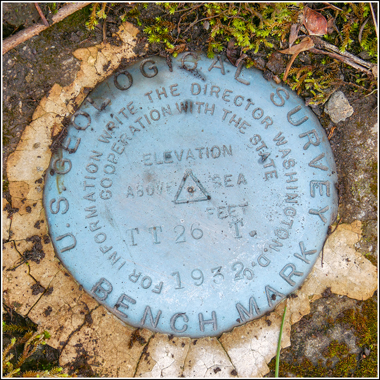
TT 26 T
TT 26 T
Spatial/elevation data
| Coordinates | N 41.63423° W 75.52538° |
| Elevation | 1696.048 ft. |
| Location | Pennsylvania
Lackawanna County Clifford Quad |
Mark description
| Type | Transit Traverse Station Disk |
| Setting | Boulder |
| Monumented | 1932 by USGS |
| Description (USGS) | Crystal Lake, 0.5 mi SE. of; 0.5 mi N. of Crystal Lake School, on Crystal Lake Road; 85 ft NW. of S. end of triangle at junction of rd. SE. to Simpson; on W. side of main rd.; in boulder 1.5 ft above ground; standard tablet stamped “TT 26 T 1932” Reference mark; 140 ft NE. of tablet; 20 ft W. of rd.; on stone catch basin; chiseled square (1693.48 ft) |
Narrative and photographs
The third mark we attempted was the only one we actually found today. The satellite imagery looked promising—we could actually see what looked like a small boulder in the field near the coordinates. But when you get to the site, things often look very different. When we drove to the intersection, I could see a small boulder or outcrop in the field. Braving the medium-high grass (ticks, don’t forget!) I walked to the boulder and found the disk set into its lower shelf. The disk is in excellent condition and is very clean, even though the rest of the boulder is covered in moss (could this be a sign that the mark has been used recently?).
When I was done, Rich suggested that I walk up the road and see if I could find the catch basin that held the reference mark. Usually these old stone catch basins have been replaced or are so overgrown that we can’t even locate them. But in this case we found it easily. It’s still in good condition, but the top and sides are covered with soil and overgrowth. I didn’t see a chiseled square on any of the exposed surfaces, and I wasn’t able to clear off the top to check it thoroughly.


