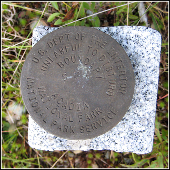
S 24
S 24
Spatial/elevation data
| Coordinates | N 44.303666° W 68.3295° |
| Elevation | Unknown |
| Location | Maine
Hancock County Southwest Harbor Quad |
Mark description
| Type | Boundary Monument |
| Setting | Granite Monument |
| Monumented | Unknown by National Park Service |
| Description (National Park Service) | Unavailable. |
Narrative and photographs
During our ten days on the island we probably passed this marker half a dozen times. Today, on our way back to Bar Harbor from our second lobster feast in Southwest Harbor, I asked Rich to stop so we could recover the mark. John probably thought I was nuts as I squished through the moss in the ditch, soggy from water pooled around the culvert, to take photos of a little disk in a stone post. To top it off, a cop car was parked about fifty feet away. Fortunately the cop left us alone as I photographed the disk and recorded the coordinates. This is one of the standard NPS boundary marker disks, in good condition. Unlike many of the others, this one is stamped. It is also set strangely off center in the post. It’s very easy to spot in a relatively open location with the bright orange witness post nearby; it’s just north of DeMuro’s Top of the Hill Restaurant on Route 102 in Southwest Harbor.


