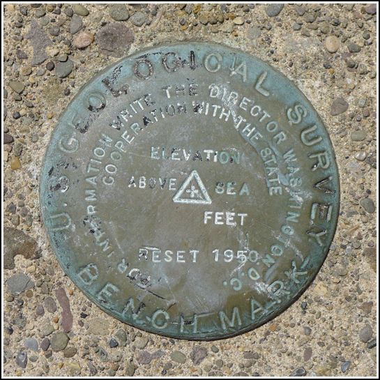
RESET 1950
RESET 1950
Spatial/elevation data
| Coordinates | N 41.64677° W 75.70338° |
| Elevation | Unknown |
| Location | Pennsylvania
Susquehanna County Lenoxville Quad |
Mark description
| Type | Bench Mark Disk |
| Setting | Bridge Abutment |
| Monumented | 1950 by USGS |
| Description (USGS) | Unavailable. |
Narrative and photographs
This was our final find on a very successful day of blueberry festivities, hiking, and benchmark hunting. When we drove slowly by and I saw this disk, I was sure we had found 24 ETL. The disk was obviously one of the thick “cookie-style” USGS disks and not a new PennDOT disk, and it was in the correct wingwall as specified by the USGS description. But when we checked, we found that although the disk is indeed a USGS benchmark, it is not 24 ETL. It’s stamped only RESET 1950. We assume that it is a reset of 24 ETL although that’s not certain. According to PennDOT’s bridge database, this bridge was constructed in 1952, which doesn’t really help to clear things up. It’s possible the bridge took a few years to be completed and that the mark was set at the beginning of the project.

