R 17
R 17
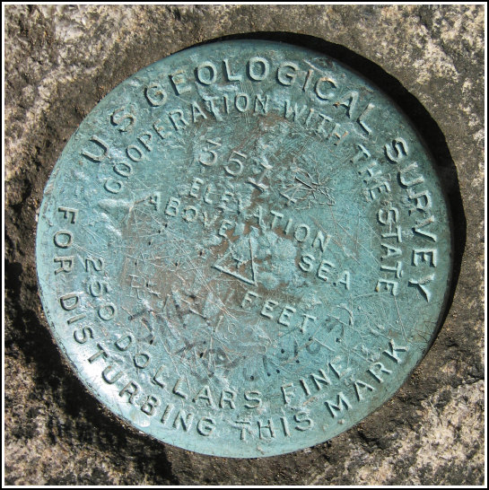
Spatial/elevation data
| Coordinates | N 38.650016° W 78.317583° |
| Elevation | 3514 ft. |
| Location | Virginia
Page County Thornton Gap Quad |
Mark description
| Type | Bench Mark Disk |
| Setting | Rock Outcrop |
| Monumented | 1928 by USGS |
| Description (USGS) | Marys Rock; 1.0 mi S. of Thornton Gap; 200 ft S. of Maidens Leap; in top of highest ledge; standard tablet stamped “R 17 1928”. Also see mention in NGS datasheet for HW3268. |
Narrative and photographs
With MARY as our main goal for the day, we began at the Buck Hollow Trail parking area and hiked WNW along the Meadow Spring Trail up to the A-T. To our dismay, when we arrived at the coordinates, we discovered that both MARY and R 17 are located atop a thin sliver of completely exposed rock. We were able to climb high enough to see the station disk and R 17, but we just couldn’t bring ourselves to climb all the way up with our equipment and stand in the ferocious wind. A trio of hardy German hikers lunching atop the rock was all too eager to help us out, and they took a few very nice closeups of both marks for us. R 17 has been scribbled on but otherwise looks to be in great condition, especially compared to its neighbor on Mary’s Rock, MARY (HW3268).

