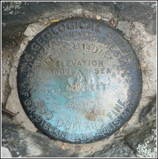
TT 14 D=STONY MAN (HW3273)
TT 14 D=STONY MAN
Recovered in Good Condition on October 1, 2006
Spatial/elevation data
| Coordinates | N 38.59785° W 78.37195° |
| Elevation | 4011 ft. |
| Location | Virginia
Page County Old Rag Mountain Quad |
Mark description
| Type | Transit Traverse Station Disk |
| Setting | Rock Outcrop |
| Monumented | 1928 by USGS |
| Description (NGS) | NGS Datasheet |
NGS recovery information
Descriptive text
The station disk and RM 2 were recovered in good condition as described. Some of the concrete holding RM 2 in place has eroded, but the disk still appears to be set solidly in the rock outcrop. Handheld GPS WAAS-corrected coordinates for RM 2 are 38 35 52.6(N) 078 22 18.4(W). RM 3 was not recovered after an extensive search. No 2-foot square rock outcrop was found at the given distance and direction from the station mark. RM 1 (azimuth mark) was not found. The given distance was driven from the entrance to Skyland Resort and the nearby rock outcrops were searched without success.Narrative and photographs
The station disk and RM 2 were recovered in good condition as described. Some of the concrete holding RM 2 in place has eroded, but the disk still appears to be set solidly in the rock outcrop. Handheld GPS WAAS-corrected coordinates for RM 2 are 38 35 52.6(N) 078 22 18.4(W).
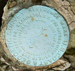
RM 3 was not recovered after an extensive search. No 2-foot square rock outcrop was found at the given distance and direction from the station mark.
RM 1 (azimuth mark) was not found. The given distance was driven from the entrance to Skyland Resort and the nearby rock outcrops were searched without success.

| Designation | Status | Condition | Image |
|---|---|---|---|
| TT 14 D=STONY MAN RM 2 | Recovered | Good |
|