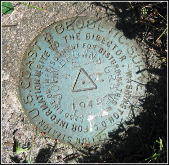
JOHN BROWNS GRAVE (PG0932)
JOHN BROWNS GRAVE
Spatial/elevation data
| Coordinates | N 44.252467° W 73.971233° |
| Elevation | 1857.25 ft. |
| Location | New York
Essex County Lake Placid Quad |
Mark description
| Type | Triangulation Station Disk |
| Setting | Square Concrete Monument |
| Monumented | 1942 by NGS |
| Description (NGS) | NGS Datasheet |
NGS recovery information
Descriptive text
The station mark, reference marks 1 and 2, and the azimuth mark were recovered in good condition. The 1989 station description and to-reach remain accurate.Narrative and photographs
The final day of our “Adirondack mini-adventure” was just right for some tri-station hunting. I’d been curious about John Brown and his grave since I started researching marks in the Lake Placid area earlier this week. We first spent some time at the monument (PG2110) and at John Brown’s grave before seeking out the tri-station. We found the station mark with ease, and it is in good condition. As mentioned in one of the recent recovery notes, the disk is now several centimeters below the surface of the ground, but it is not covered and is quite easy to see.
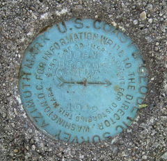
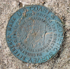
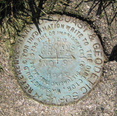
While we were photographing the station, the caretaker approached us with some background information: he knew where both reference marks were located, and more importantly, he pointed out that RM 1 is now the surveyors’ mark of choice (they apparently visit the area quite often). This made sense when we consulted our datasheets and found that RM 1 has been surveyed as a GPS station, with adjusted coordinates, as of July 1997. Both reference marks (PG0931 and PG0933) were found easily, and the azimuth mark (PG0930) provided just a slightly more challenging hunt.


| Designation | Status | Condition | Image |
|---|---|---|---|
| JOHN BROWNS GRAVE AZ | Recovered | Good |
|
| JOHN BROWNS GRAVE RM 1 | Recovered | Good |
|
| JOHN BROWNS GRAVE RM 2 | Recovered | Good |
|