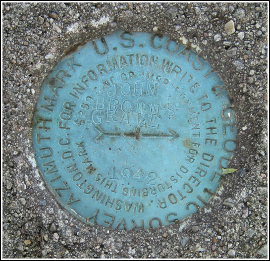
JOHN BROWNS GRAVE AZ (PG0930)
Recovered in Good Condition on August 6, 2006
Spatial/elevation data
| Coordinates | N 44.256533° W 73.97378° |
| Elevation | 1867.73 ft. |
| Location | New York
Essex County Lake Placid Quad |
Mark description
| Type | Azimuth Mark Disk |
| Setting | Square Concrete Monument |
| Monumented | 1942 by NGS |
| Description (NGS) | NGS Datasheet |
NGS recovery information
Descriptive text
Recovered in good condition. The disk is an azimuth mark disk, not a reference mark disk. Power pole number 25-182 was not found in the vicinity. The witness post still exists. Autonomous (non-corrected) handheld GPS coordinates for the azimuth mark are 44 15 23.5(N) 073 58 25.6(W).Narrative and photographs
For more information about this reference mark, see its parent mark JOHN BROWNS GRAVE.
Rich and I recovered this azimuth mark as part of our recovery of PG0932, the JOHN BROWNS GRAVE tri-station. The azimuth mark is in good condition. We had some trouble finding it, as there is no longer a power pole 14 feet from the mark, and the scaled coordinates took us to a point just a bit too far south along John Brown Road. Once we walked just a few more yards north, however, we spotted the witness post and then the mark.


