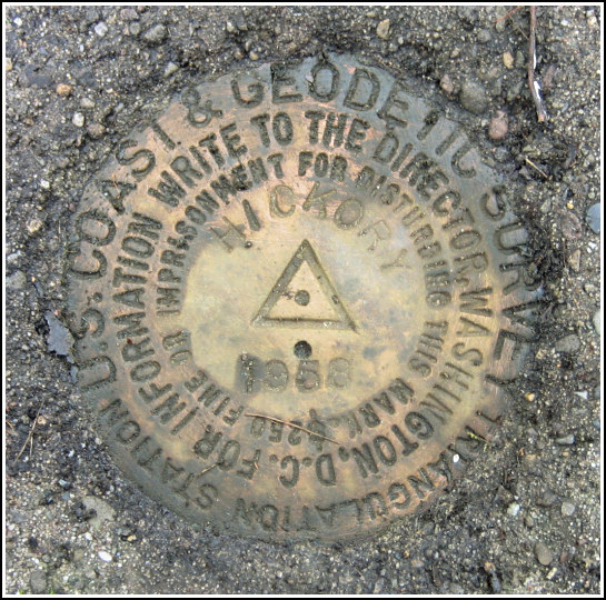
HICKORY (LY2742)
HICKORY
Spatial/elevation data
| Coordinates | N 41.062416° W 75.681466° |
| Elevation | 1825 ft. |
| Location | Pennsylvania
Carbon County Hickory Run Quad |
Mark description
| Type | Triangulation Station Disk |
| Setting | Square Concrete Monument |
| Monumented | 1958 by NGS |
| Description (NGS) | NGS Datasheet |
NGS recovery information
Descriptive text
The station mark and both reference marks were recovered in good condition. The 18-inch birch tree and standard metal witness post were not found. There is a one-foot high metal stake approximately one foot northwest of the station. The blazed tree and dim track road no longer exist. It is necessary to hike the final 0.37 miles to the station. Autonomous (non-corrected) handheld GPS coordinates for RM 1 are 41 03 45.4(N) 075 40 53.3(W). Autonomous (non-corrected) handheld GPS coordinates for RM 2 are 41 03 44.9(N) 075 40 52.6(W).Narrative and photographs
Initially drawn to this area by a USGS description of a PA Turnpike Commission disk supposedly located on one of the nearby underpasses, we noticed HICKORY just a few miles to the north and decided it would make a nice morning hike and hunt. As has been typical this Summer, we had to push back our trip for four days waiting for the rain to stop. Today we were able to enjoy a few hours of dry weather (and even some weak sunshine!).
This area, at least judging by the to-reach, has changed little since 1958. The directions were easy to follow and we found that the roads in the park matched the description quite well. We took the long, slow drive along the gravel road toward the boulder field, then turned toward the Fourth Run Trail. Unfortunately, we were not able to drive as far as the 1958 crew had; a locked gate blocked our way less than a quarter-mile along the road to Fourth Run Trail. We parked at the gate and hiked the remaining distance north and then west along the woods road to the point at which the road makes a turn again to the north, just a few hundred yards east of the Turnpike. This is where we expected to find some sign of the dim track road (and, less likely, the blazed tree), but we found nothing. A bushwhack was required over the remaining 0.4 miles or so to the station.
Arriving at the hilltop, we were discouraged by the thick growth of ferns and other greenery. But we needn’t have worried about finding the station. I immediately stubbed my toe on a short metal stake that, apparently, now serves as a witness marker for the station just a foot away. (The official witness post mentioned in the station description is gone, so we marked the short stake with pink flagging tape to indicate the nearby station.)
We split up to find the reference marks. Rich spotted RM2 immediately, while locating RM1 required measuring tape and compass and trowel. After documenting everything with photographs we hiked back to the woods road by a slightly different route, but still saw no sign of the dim track road.


| Designation | Status | Condition | Image |
|---|---|---|---|
| HICKORY RM 1 | Recovered | Good |
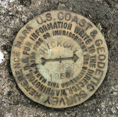
|
| HICKORY RM 2 | Recovered | Good |
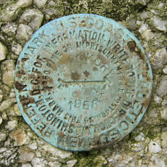
|