W 18 (PE0372)
W 18
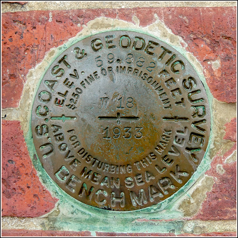
Spatial/elevation data
| Coordinates | N 44.45865° W 68.92509° |
| Elevation | 59.12 ft. |
| Location | Maine
Waldo County Searsport Quad |
Mark description
| Type | Bench Mark Disk |
| Setting | Brick Wall |
| Monumented | 1933 by NGS |
| Description (NGS) | NGS Datasheet |
NGS recovery information
Descriptive text
Recovered in good condition.Narrative and photographs
When researching this mark ahead of time I had some trouble figuring out which building it was set into. According to the description, the building was the post office in 1934 and the historical society in 1983—both of which you’d think would be easy enough to identify, but surprisingly it was a challenge. Google Street View wasn’t much help either, although I can just make it out on the Street View now that I know where to look.
We stopped along our way from Belfast to Bar Harbor to search for this mark. It was raining heavily at the time, so fortunately it was a quick and easy find.
The mark is set at the northeast corner of the building, which appears to be unoccupied at this time but most recently housed “Capehouse Coffee & Tea.” The building is on the southeast side of Route 1 directly south of the T-intersection of Route 1 and Knox Bros. Avenue. The mark is set vertically in the north brick wall of the building about 5 inches to the right of an aluminum downspout and about 5 inches below a plaque indicating that the property has been placed on the National Register of Historic Places. The disk was in excellent condition at the time of our visit.

")