K 17 (PE0321)
K 17
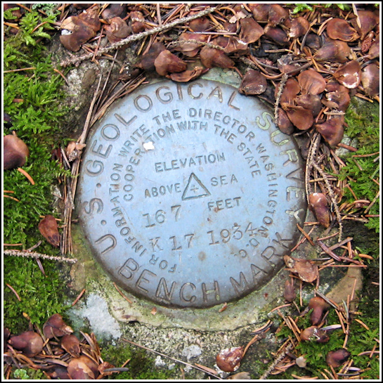
Spatial/elevation data
| Coordinates | N 44.3461° W 68.37856° |
| Elevation | 166.69 ft. |
| Location | Maine
Hancock County Bartlett Island Quad |
Mark description
| Type | Bench Mark Disk |
| Setting | Rock Outcrop |
| Monumented | 1934 by USGS |
| Description (NGS) | NGS Datasheet |
NGS recovery information
Descriptive text
Recovered in good condition. Handheld GPS coordinates for the station are 44 20 48.2(N) 068 22 42.8(W).Narrative and photographs
After our morning full of riding on the “quiet side” of the island, Rich and I decided to investigate a witness sign we’d noticed on a tree when passing by earlier in the day. It was a standard USGS witness sign, so I was pretty sure a benchmark was hiding nearby. Our datasheets indicated that it was most likely K 17, which for some reason we had never searched for in the past. At first I was fooled by the heavy blanket of moss covering everything in the general area; nothing appeared to be a rock outcrop and I wondered if I had the wrong spot. But I persevered and moved a little farther back into the dark woods from the road, and there was the blue disk, poking out from among the moss on the highest point of a mound. It is is excellent condition. I recommend a tripod (which, of course, I didn’t have at the moment) for taking photos of this mark.


