K 9 (PE0277)
K 9
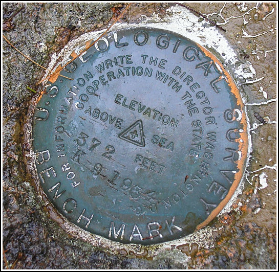
Spatial/elevation data
| Coordinates | N 44.3772° W 68.2556° |
| Elevation | 371.56 ft. |
| Location | Maine
Hancock County Salsbury Cove Quad |
Mark description
| Type | Bench Mark Disk |
| Setting | Rock Outcrop |
| Monumented | 1934 by USGS |
| Description (NGS) | NGS Datasheet |
NGS recovery information
Descriptive text
Recovered in good condition. Handheld GPS coordinates for the mark are 44 22 37.4(N) 068 15 20.2(W).Narrative and photographs
Our second mark on this damp day, K 9 proved easy to find, but difficult to document. Our biggest problem was the swarms of mosquitoes fiercely guarding the mark! Old Route 233 is, as we expected, overgrown and mostly just a grassy clearing in the area of the benchmark. We found the large rock ledge and the mark easily, but trying to photograph it was murder amidst the swarming and biting bugs. We spotted a USGS witness sign about 22 feet to the west of the mark. It is not mentioned in the NGS description but is, in fact, part of the 1977 revised USGS description.


(Recovered on September 11, 2002)
N 44° 22.632’ W 068° 15.336’
While vacationing on M.D.I. I decided to search for a few local benchmarks. I drove out along Route 233 from Bar Harbor and easily found the mark using the historical description. At the station my Garmin GPSmap76 receiver indicated approximately 83 feet from the posted coordinates. The disc is quite visible and is in excellent condition. ~Rich in NEPA~

