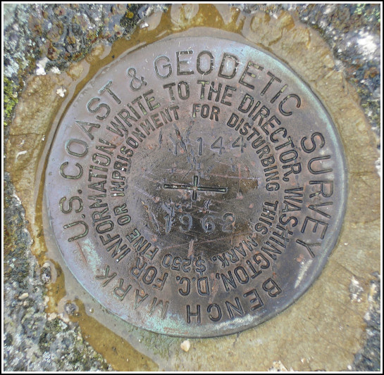
Y 144 (PE0273)
Y 144
Spatial/elevation data
| Coordinates | N 44.364717° W 68.3153° |
| Elevation | 74.26 ft. |
| Location | Maine
Hancock County Southwest Harbor Quad |
Mark description
| Type | Bench Mark Disk |
| Setting | Rock Outcrop |
| Monumented | 1962 by NGS |
| Description (NGS) | NGS Datasheet |
NGS recovery information
Descriptive text
Recovered in good condition. Handheld GPS coordinates for the station are 44 21 53.0(N) 068 18 55.1(W).Narrative and photographs
Y 144 was our fourth and final mark on this soggy Saturday. Rich stayed in the car for this one, since he had already found it and knew I would have no trouble. I scampered quickly up the bank on the south side of Route 198, found the ledge and the mark immediately. The mark may have been in recent use; I found a piece of pink flagging tape tied to a branch adjacent to the boulder.


(Recovered on September 12, 2002)
N 44° 21.879’ W 068° 18.914’
While vacationing on M.D.I. I decided to search for a few local benchmarks. I drove out along Route 233 from Bar Harbor and easily found the mark using the historical description. At the station my Garmin GPSmap76 receiver indicated approximately 66 feet from the posted coordinates. The disc is quite visible and is in excellent condition. ~Rich in NEPA~


