TT 24 A USGS 1942 (LY2786)
TT 24 A USGS 1942
Recovered in Good Condition on October 12, 2008
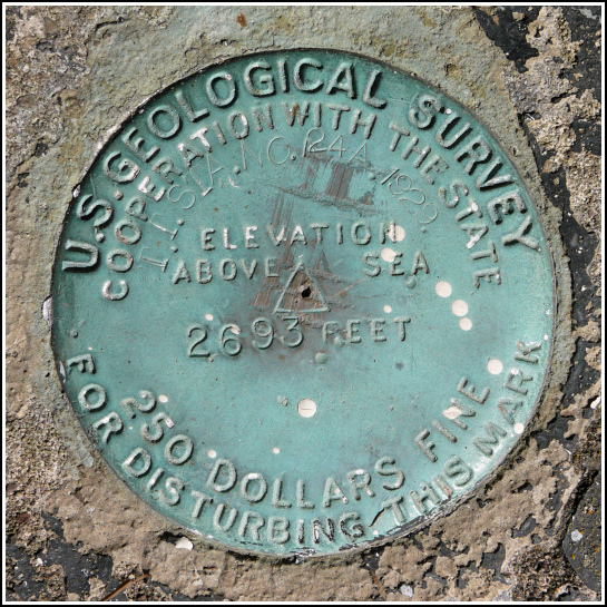
Spatial/elevation data
| Coordinates | N 41.715056° W 75.560741° |
| Elevation | 2692.1 ft. |
| Location | Pennsylvania
Susquehanna County Clifford Quad |
Mark description
| Type | Transit Traverse Station Disk |
| Setting | Concrete Step |
| Monumented | 1929 by USGS |
| Description (NGS) | NGS Datasheet |
NGS recovery information
Descriptive text
Recovered in good condition. The Elk Mountain Lookout Tower has been removed from the site, but the concrete step is still in place. This station is used as a reference mark (RM 1) for triangulation station ELK 2.Narrative and photographs
The history of this disk is intertwined with the history of the various towers and the NGS triangulation station nearby. This USGS mark was the first to be placed on Elk Mountain, and it’s the one that appears on topo maps of the area prior to 1994.
When TT 24 A was established in 1929, the concrete base into which it was set served as the base of the steps leading to the top of the fire lookout tower, which is now gone. This disk was also used as a reference mark (RM 1) for triangulation station ELK 2, which was set in 1959.
