AIRWAY BCN 19 S OF SCRANTON (LY2723)
AIRWAY BCN 19 S OF SCRANTON
Spatial/elevation data
| Coordinates | N 41.342656° W 75.66022° |
| Elevation | Unknown |
| Location | Pennsylvania
Lackawanna County Avoca Quad |
Mark description
| Type | Landmark/Intersection Station |
| Setting | Airway Beacon |
| Monumented | 1959 by NGS |
| Description (NGS) | NGS Datasheet |
NGS recovery information
Descriptive text
Recovered in destroyed condition.Narrative and photographs
Zhanna has not yet searched for this mark.
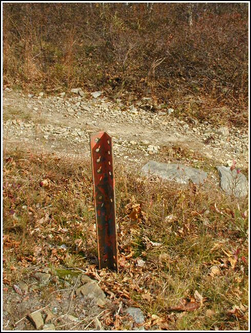
Station landmark no longer exists.
This station was located and identified but the station landmark was destroyed. The airway beacon tower was dismantled and removed. The four anchor points for the beacon tower legs remain protruding roughly 20-24 inches above the ground. The west leg anchor is 30 feet east of a powerpole. The east leg anchor is 6 feet northwest of the centerline of a jeep trail. At what would have been the center of the base of the tower, a Garmin GPSmap76 receiver was used to record WAAS-corrected coordinates which were identical to the adjusted coordinates listed on the NGS datasheet. ~Rich in NEPA~
Edit Note: An official recovery report was submitted to NGS and subsequently they have declared this station as having been destroyed.


