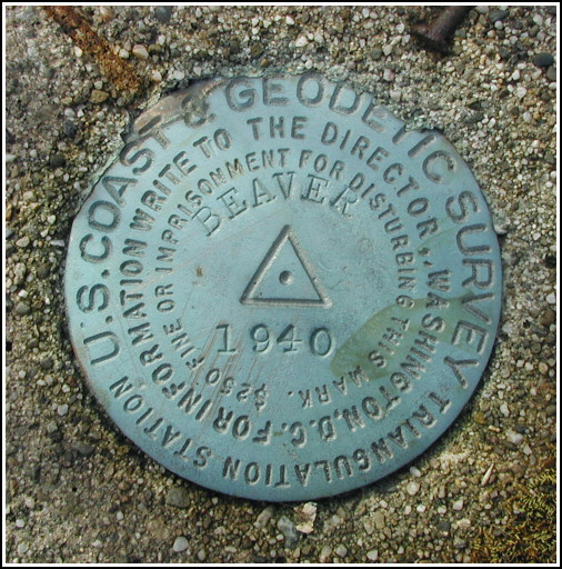
BEAVER (LY2682)
BEAVER
Spatial/elevation data
| Coordinates | N 41.221633° W 75.08165° |
| Elevation | 1414 ft. |
| Location | Pennsylvania
Pike County Twelvemile Pond Quad |
Mark description
| Type | Triangulation Station Disk |
| Setting | Square Concrete Monument |
| Monumented | 1940 by NGS |
| Description (NGS) | NGS Datasheet |
NGS recovery information
Descriptive text
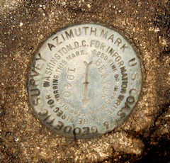
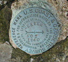
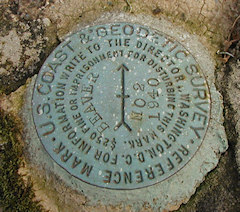
The station mark and reference marks 1 and 2 were recovered in good condition. The azimuth mark was found in poor condition with its setting disturbed. The monument has been partially uprooted as if struck by a plow, and it lies tipped at a severe angle though it is still embedded in the ground. Its approximate location is N41°13’30’’ W075°04’46’’ as determined by a Garmin GPSmap76 receiver with active remote antenna. (This location is approximately 87 feet northeast of PP&L powerline pole 19041 73415/39661.) Triangle blazes were not found.Narrative and photographs
The recovery of the station mark and reference marks 1 and 2 was straightforward. They are located on an easily accessible knoll on State Forest land less than 200 feet west of Route 402. All three marks are in good condition.
Finding the azimuth mark proved difficult. We drove a bit more than a quarter mile north on Route 402, then began to search along the western side of the highway. More than thirty minutes went by before Rich finally found something interesting enough to investigate. He’d come across a corner of concrete just poking out of the ground. We cleared the area as well as we could and discovered that this was in fact the concrete monument holding the azimuth mark, but it was lying in the ground tipped on its side as if it had been struck by heavy equipment. The disk itself is in good enough condition that we could positively identify it, but because of the condition of the setting the mark’s value has likely been compromised.


Station recovered in good condition.
This first order triangulation station is situated atop a brush-covered knoll within a section of Delaware State Forest. The 1940 “to reach” directions are still fairly usable. The triangle-blazed pine and oak trees no longer exist, but there is a powerpole at about the right spot. A handheld GPS receiver was helpful in pinpointing the location of the station.
The station and its two reference marks were found as described. The sparse description for the azimuth mark made locating it very difficult. It was eventually found with its setting extremely disturbed and in poor condition. The concrete monument appears to have been struck hard (perhaps by a snowplow blade), partially uprooted and tipped sideways, and became covered over again by accumulated soil and vegetation. It is closer to 0.27 miles north along Rt. 402 of the station, and 87 feet northeast of powerpole number PP&L 19041 73415/39661.
At the station a Garmin GPSmap76 receiver with active remote antenna was used to record WAAS-corrected coordinates which were identical to the adjusted coordinates listed on the NGS datasheet. All marks are now well exposed, in good condition (except as noted for the azimuth mark), and the stamped designations are legible. ~Rich in NEPA~


| Designation | Status | Condition | Image |
|---|---|---|---|
| BEAVER AZ MK | Recovered | Poor |
|
| BEAVER RM 1 | Recovered | Good |
|
| BEAVER RM 2 | Recovered | Good |
|