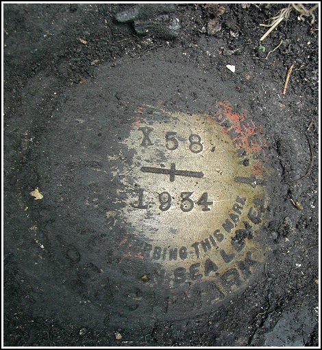
X 58 (LY1576)
X 58
Spatial/elevation data
| Coordinates | N 41.337° W 75.518267° |
| Elevation | 1561.26 ft. |
| Location | Pennsylvania
Lackawanna County Moscow Quad |
Mark description
| Type | Bench Mark Disk |
| Setting | Concrete Base |
| Monumented | 1934 by NGS |
| Description (NGS) | NGS Datasheet |
USGS recovery information
View reportNarrative and photographs
I was in the right place at the right time today. In Moscow today on another mission, I happened to notice some activity on the tracks alongside Route 435. The Steamtown train stood at the old Moscow station, getting ready to leave. I parked in a small lot right across the tracks from the station to watch the train depart.
As I sat there I remembered there was supposed to be a benchmark on the base of a pedestrian walkway somewhere near the station, though I didn’t have the datasheet with me. After the train pulled away, I noticed that there were banners hanging at the station that mentioned “Railroad History” and what looked like stands of books and pamphlets and refreshments.
I went to talk to the men at the station, figuring they might know something about the old walkway. “Sure,” one man said, pointing it out, “One part of the base is right across the tracks.” I could barely see it because it was wildly overgrown with grass and weeds. I hoped that the mark was indeed on that (the southwest) base and not on the northeast one, which I was informed was destroyed. The men said it was no problem if I crossed the tracks to check it out, so I did.
As I pushed some of the weeds aside, I could see “U.S.G.S. BM” painted on the concrete in large yellow letters! This was a good sign. The fact that the top corner of the base just above the letters had completely crumbled was not a good sign. I did see several large chunks of concrete nearby on the ground, so I checked those. Nothing.
Then I noticed that there was another part of the base, flush with the ground, that was mostly covered by mud. I dug through an inch or so of lovely black muck to uncover the mark. The disk is in excellent condition, and the date and designation are clearly legible. The description is accurate except that the walkway itself no longer exists.
The postcard displayed with the images was reproduced in the 1997 book “Wish You Were Here—A Picture Postcard History of Lackawanna County” by Jack Hiddlestone. The caption reads: “This foot bridge that safely took passengers from the station to Main Street and back, was constructed in 1913. This card shows the Delaware, Lackawanna & Western tracks with the Moscow station at the right. The bridge was dismantled in 1971. Card dated 9/16/14.” The concrete base at the left edge of the card is the one that holds the mark.


