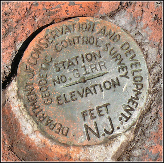
GIRR (LY2633)
GIRR
Recovered in Good Condition on April 19, 2008
Previous attempt (April
10, 2007)
Spatial/elevation data
| Coordinates | N 41.119241° W 74.945486° |
| Elevation | 689 ft. |
| Location | New Jersey
Sussex County Flatbrookville Quad |
Mark description
| Type | Geodetic Control Survey Disk |
| Setting | Rock Outcrop |
| Monumented | 1938 by New Jersey Division of Conservation and Development |
| Description (NGS) | NGS Datasheet |
NGS recovery information
Descriptive text
The station and reference marks 1 and 2 were recovered in good condition. The station is a geodetic control survey disk. This land is now part of the Delaware Water Gap National Recreation Area. The top of the knoll can be accessed via a short hike through open woods from Old Mine Road. Handheld GPS coordinates for RM 1 are 41 07 09.4(N) 074 56 43.0(W). Handheld GPS coordinates for RM 2 are 41 07 10.1(N) 074 56 44.4(W).Narrative and photographs


| Designation | Status | Condition | Image |
|---|---|---|---|
| GIRR RM 1 | Recovered | Good |
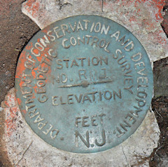
|
| GIRR RM 2 | Recovered | Good |
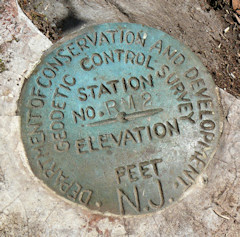
|