A 347 (LY2082)
A 347
Spatial/elevation data
| Coordinates | N 41.37675° W 74.690094° |
| Elevation | 470.15 ft. |
| Location | New York
Orange County Port Jervis North Quad |
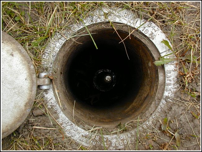
Mark description
| Type | Steel Rod |
| Setting | Pipe Cap |
| Monumented | 1978 by NGS |
| Description (NGS) | NGS Datasheet |
Narrative and photographs
I found this mark while in the area for some Monday morning geocaching with Rich in NEPA. I have little to add to the accurate descriptions provided by Patrick and Rich. The historic descriptions and coordinates lead directly to the station, and the rod, pipe and access cover all appear to be in very good condition. The designation and date are stamped on the rim surrounding the access cover. This is the first of this type of mark I’ve encountered.


This high order horizontal and vertical control station is easily located in Orange Square Park using the historical descriptions. The station is comprised of a stainless steel rod with an indentation in the top center, and is set below the surface of the ground and enclosed in a PVC pipe with a hinged white access cover level with the ground. Surprisingly, even with a reasonably clear view of most of the sky and with an EPE of 7.8’ my Garmin GPSmap76 receiver indicated 11’ from the posted coordinates. The mark appears to be in excellent condition. ~Rich in NEPA~


.")

