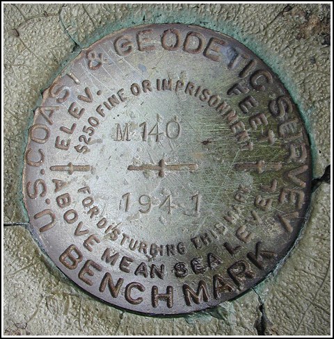
M 140 (LY0621)
M 140
Spatial/elevation data
| Coordinates | N 41.406133° W 74.740033° |
| Elevation | 488.44 ft. |
| Location | New York
Orange County Port Jervis North Quad |
Mark description
| Type | Bench Mark Disk |
| Setting | Bridge Abutment |
| Monumented | 1941 by NGS |
| Description (NGS) | NGS Datasheet |
Narrative and photographs
This chilly, wet day was just perfect for hunting down some benchmarks. We found this disk as described (although it is located on the southeast abutment, not the northwest as stated in the 1982 description) and in good condition. The date and designation are legible.
Oh, and I did have the nerve to cross the bridge. Unfortunately, the disk on the other side has been vandalized.


(Recovered on June 30, 2003)
N 41° 24.372’ W 074° 44.404’
This vertical control station is located on the top surface of the northeast end of the southeast abutment of an iron girder railroad bridge spanning the Delaware River near the fishing access in Sparrowbush, NY on Hook Rd. off Rt. 97. It’s a short climb to the railbed. At the station mark my Garmin GPSmap76 receiver indicated 40.9 feet from the posted coordinates. The disk is in very good condition and the stamped designation is legible. ~Rich in NEPA~


