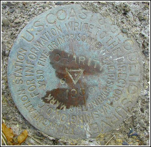
CHARITY (LY1703)
CHARITY
Spatial/elevation data
| Coordinates | N 41.500966° W 75.684983° |
| Elevation | 1459.63 ft. |
| Location | Pennsylvania
Lackawanna County Dalton Quad |
Mark description
| Type | Triangulation Station Disk |
| Setting | Square Concrete Monument |
| Monumented | 1959 by NGS |
| Description (NGS) | NGS Datasheet |
Narrative and photographs
I’d been considering searching for these marks for quite some time, and this week I decided to try. I was somewhat daunted by the fact that, at least according to the description, they were located on the property of a local school for “troubled youth.” I didn’t relish the thought of trespassing there, so I first checked with and obtained permission from Sister Margaret. (She was gracious and accommodating, though I got the definite impression that you don’t want to mess with her.)
When I arrived at the school after work and began to make my way toward the coordinates, I was in for a surprise. Apparently the land that the marks are on is no longer Lourdesmont property. It’s just over the border, behind some new homes. Since I was already within 100 feet, I thought I’d try anyway. Although neighborhood residents were out and about, no one even gave me a second look.
The situation didn’t appear too favorable at first glance, as the yard behind one of the homes was completely torn up. Fortunately, the station mark was still present just at the edge of the upturned earth, and it was an easy find. The two reference marks required a bit more searching, but they are both still in place as well. The station mark is in good condition with some slight scratches; the date and designation are clear. There were some faint traces of yellow and orange paint on the monument surrounding the mark. I hope the property owners and construction crews respect these marks and that I’m not the last to recover them successfully!


| Designation | Status | Condition | Image |
|---|---|---|---|
| CHARITY RM 1 | Recovered | Good |
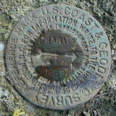
|
| CHARITY RM 2 | Recovered | Good |
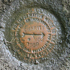
|