853.89 (LY1344)
853.89
Spatial/elevation data
| Coordinates | N 41.478783° W 75.56015° |
| Elevation | 853.68 ft. |
| Location | Pennsylvania
Lackawanna County Olyphant Quad |
Mark description
| Type | Chiseled Cross |
| Setting | Stone Culvert |
| Monumented | Unknown by Delaware and Hudson Railroad |
| Description (NGS) | NGS Datasheet |
Narrative and photographs
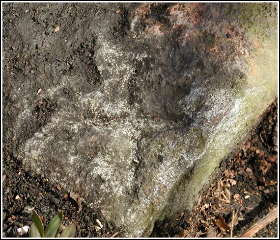
This was the first stop on this Sunday’s up-valley benchmark bike tour. Rich and I rode from his house down to the tracks, where we picked up this mark and a few others, and then we worked our way over toward Archbald, Jermyn and Mayfield via the River Trail and the roads. This was my first experience locating a chiseled cross mark. It was tricky to see, but even harder to photograph! Still, it’s in good condition for having been carved so long ago and probably exposed for many years. Rich’s description is accurate.


(Recovered on April 10, 2003)
N 41° 28.727’ W 075° 33.609’
This vertical control station is about 1/3 mile east-northeast of the intersection of the D&H railroad and Hill St. in Jessup, or 2/3 mile west and southwest from the intersection of the D&H railroad and Breaker St. in Winton. The historic description is confusing with regard to the cardinal compass directions at the site. A chiseled cross is located in the extreme west corner of the top surface of the south parapet of a stone arch culvert over Grassy Island Creek. At the station mark my Garmin GPSmap76 receiver indicated 73.3 feet from the NGS datasheet coordinates. The mark was buried under a layer of packed dirt and is fairly well defined … after 69 years!
~Rich in NEPA~


