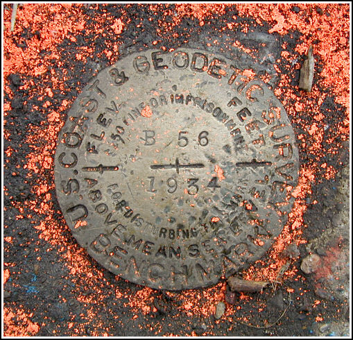
B 56 (LY1338)
B 56
Recovered in Good Condition on February 12, 2005
Spatial/elevation data
| Coordinates | N 41.43795° W 75.648466° |
| Elevation | 709.2 ft. |
| Location | Pennsylvania
Lackawanna County Scranton Quad |
Mark description
| Type | Bench Mark Disk |
| Setting | Bridge Abutment |
| Monumented | 1934 by NGS |
| Description (NGS) | NGS Datasheet |
NGS recovery information
Descriptive text
Recovered in good condition. Handheld GPS WAAS-corrected coordinates for the station are 41 26 16.62(N) 075 38 54.48(W).Narrative and photographs
For a change of pace, I decided to seek out some Scranton benchmarks this morning. After finding MINOOKA RESET in Scranton’s south side, I drove to Green Ridge, turned down Race Street into the Plot section, and then spotted the 1904 truss bridge from a block away. The station has been in recent use; it is circled in fluorescent orange paint and orange markings have been made on the bridge as well. The disk is in good condition with all stamping clearly legible. The description is accurate, though it might be better to reference the nearby intersection of Race Street and Amelia Avenue than the intersection of Depot Street and Amelia Avenue, which is 500 feet from the mark.


