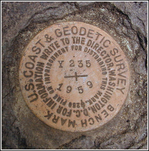
Y 235 (LY1234)
Y 235
Spatial/elevation data
| Coordinates | N 41.45175° W 75.1302° |
| Elevation | 889.82 ft. |
| Location | Pennsylvania
Pike County Hawley Quad |
Mark description
| Type | Bench Mark Disk |
| Setting | Boulder |
| Monumented | 1959 by NGS |
| Description (NGS) | NGS Datasheet |
NGS recovery information
Descriptive text
The station mark was recovered in good condition. The 2 foot pipe culvert could not be found. The station is approximately 62 feet SW of the NW end of a pipe culvert under the road and 90 feet NNE of PPL powerpole 31122/71789/N47871. Road T367 is now paved. To reach the station from the intersection of U.S. Route 6 and T367 (Decker Hollow Road), travel approximately 2.0 miles NE on T367 to the station on the left.Narrative and photographs
Rich and I were in the area on this cloudy, cool Monday morning attempting a First Find on a new geocache. We had some time remaining after I located another nearby cache—one that Rich had already found—so we pulled out our pack of datasheets and noticed that this mark was very close by. It was a straightforward find because the proper boulder is the only one in the area even remotely the size described. We cleared the mark of an accumulation of soil and moss, and noted that the disk appeared to be in excellent condition. We could not, however, locate the pipe culvert mentioned in the description, so we took measurements from a nearby powerpole and culvert. The given to-reach directions were not checked.


Recovered in good condition.
This second order vertical control station is located on the top surface of a large boulder on the west side of Decker Hollow Road (T367) approximately 2.0 miles north from the intersection of PA Rt. 6. The historical description is no longer reliable. Station mark is 62 feet southwest of the northwest end of a pipe culvert under the roadway, 90 feet north-northeast of PPL powerpole 31122/71789/N47871, and 36 feet northwest of the centerline of the road. At the station a Garmin GPSmap76 receiver with remote active antenna was used to record autonomous (non-corrected) coordinates which were 477 feet from the scaled coordinates listed on the NGS datasheet. The disk is now well exposed, in excellent condition, and the stamped designation is clearly legible. ~Rich in NEPA~


