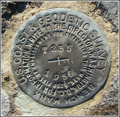
T 235 (LY1157)
T 235
Spatial/elevation data
| Coordinates | N 41.3284° W 75.1372° |
| Elevation | 1612.53 ft. |
| Location | Pennsylvania
Pike County Promised Land Quad |
Mark description
| Type | Bench Mark Disk |
| Setting | Boulder |
| Monumented | 1959 by NGS |
| Description (NGS) | NGS Datasheet |
NGS recovery information
Descriptive text
Mark recovered in good condition. It is set in the top of the third large boulder from the east, at the powerline clearing along Lake Laura Road. The mark is on property owned by the Blooming Grove Hunting and Fishing Club, HC 8 Box 8066, Hawley, PA 18428. A gate key can be obtained from Scott F. Savini, General Manager, 570-775-7371.Narrative and photographs
After our disappointing experience at a nearby bridge trying to locate another mark in this series, Rich and I took the 3/4 mile walk along Lake Laura Road to find this mark. This is a surprisingly pretty location, and even in November it was warm here in the sunshine. The mark is located on the third large boulder from the east at the intersection of the powerline cut and Lake Laura Road. It was found in good condition with legible stamping.


N 41° 19.704’ W 075° 08.234’
Recovered in good condition.
This second order vertical control station is set in the top surface of a large boulder directly under a high-tension powerline running north-south and crossing Lake Laura Road. The historical description leads reliably to the station. There are four boulders centered in the clearing and the station is on the 3rd one (not necessarily the largest) from the east end. At the station a Garmin GPSmap76 receiver with remote active antenna was used to record WAAS-corrected coordinates which were 81.3 feet from the scaled coordinates listed on the NGS datasheet. The mark is well exposed, and the stamped designation is clearly legible. ~Rich in NEPA~


