DLW
Spatial/elevation data
| Coordinates | N 41.1795° W 75.417833° |
| Elevation | 1933.55 ft. |
| Location | Pennsylvania
Monroe County Tobyhanna Quad |
Mark description
| Type | Survey Mark |
| Setting | Concrete Base |
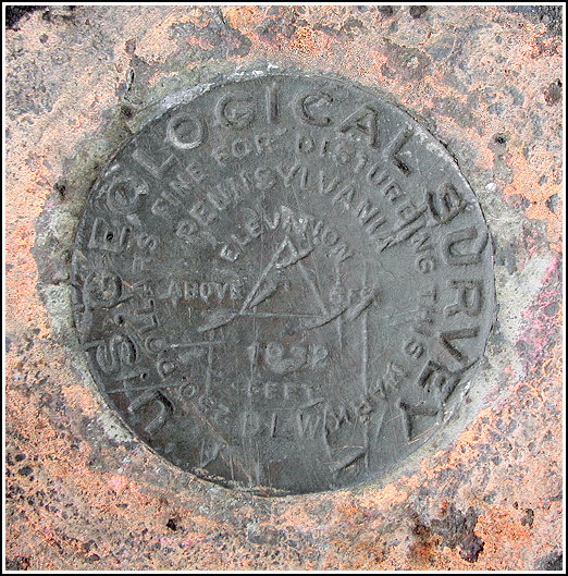
| Monumented | 1932 by USGS |
| Description (NGS) | NGS Datasheet |
NGS recovery information
Descriptive text
The stamping is worn and difficult to discern. The mark appears to be in good condition otherwise.USGS recovery information
View reportNarrative and photographs
On our way to pick up a moving geocache in the nearby Tobyhanna State Park, Rich and I drove past the railroad station and control tower and he mentioned that he thought a benchmark was located nearby. Although it was a horribly cold and windy day and we could barely stand to be outside, on our way back home we did stop to search for the mark. We found it beneath some gravel at the base of the control tower as described, just east of Route 1. The stamping is eroded and very difficult to make out, but the mark doesn’t appear to have been disturbed.


N 41° 10.771’ W 075° 25.074’
Recovered in good condition.
This second order vertical control station is set in the northeast corner of a concrete slab flush with the ground and adjacent to an abandoned two-story concrete railroad control tower. The 1956 historical description leads reliably to the station. The mark was covered with dirt and gravel. At the station a Garmin GPSmap76 receiver with remote active antenna was used to record autonomous (non-corrected) coordinates which were 40.2 feet from the scaled coordinates listed on the NGS datasheet. The station mark is in fair condition, and the stamped designation is barely legible. ~Rich in NEPA~


