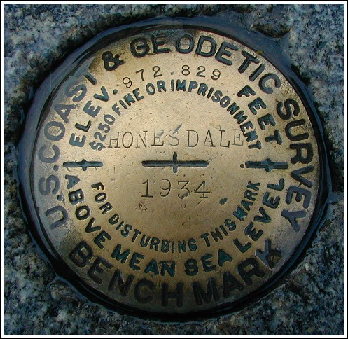
HONESDALE (LY1067)
HONESDALE
Recovered in Good Condition on June 21, 2003
Spatial/elevation data
| Coordinates | N 41.574516° W 75.254933° |
| Elevation | 972.2 ft. |
| Location | Pennsylvania
Wayne County Honesdale Quad |
Mark description
| Type | Bench Mark Disk |
| Setting | Stone Post |
| Monumented | 1934 by NGS |
| Description (NGS) | NGS Datasheet |
Narrative and photographs
Apparently this benchmark is treated like royalty! It’s on a stone in a very prominent location on the square just as described, and it’s surrounded by four taller monuments whose purpose is unknown to me. The disk is in excellent condition. It was a chilly day, but the rain held off while we were exploring this beautifully maintained park.

