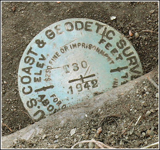
T 30 (LY0754)
T 30
Recovered in Good Condition on April 10, 2007
Spatial/elevation data
| Coordinates | N 41.101433° W 74.962383° |
| Elevation | 347.06 ft. |
| Location | New Jersey
Sussex County Flatbrookville Quad |
Mark description
| Type | Bench Mark Disk |
| Setting | Bridge Abutment |
| Monumented | 1942 by NGS |
| Description (NGS) | NGS Datasheet |
NGS recovery information
Descriptive text
Handheld GPS coordinates for the station are 41 06 5.2(N) 074 57 44.6(W).Narrative and photographs
This “easy roadside bench mark” was more of a challenge than we’d expected. It was in an awkward place to reach and to photograph, and we had plenty of thorny branches to clear before we could even get a good look at the mark. The mark is in good condition; however, a new bridge has been built and this old bridge deprecated. I wonder whether its days are numbered.


 is in the foreground.")

