S 30 (LY0753)
S 30
Recovered in Good Condition on April 10, 2007
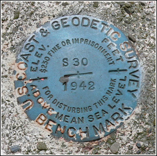
Spatial/elevation data
| Coordinates | N 41.09803° W 74.97633° |
| Elevation | 421.97 ft. |
| Location | New Jersey
Sussex County Flatbrookville Quad |
Mark description
| Type | Bench Mark Disk |
| Setting | Round Concrete Monument |
| Monumented | 1942 by NGS |
| Description (NGS) | NGS Datasheet |
NGS recovery information
Descriptive text
The white board fence no longer exists. Handheld GPS coordinates for the station are 41 05 52.9(N) 074 58 34.8(W).Narrative and photographs
The station mark was found in good condition. The private road is a woods road, blocked by a cable, leading south toward the river (near Wallpack Bend). The white board fence no longer exists. The original reference post is no longer at the site, but an orange stake marked “FHWA” now marks the spot. White plastic sheeting in the form of an X over the mark marks its location for photogrammetric purposes.
.")


