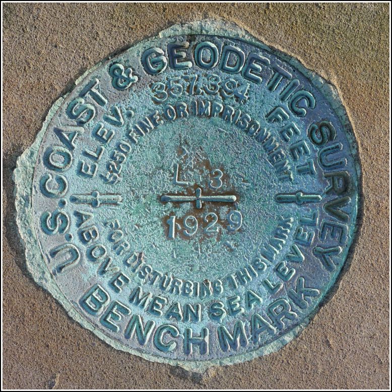
L 3 (KW0854)
L 3
Spatial/elevation data
| Coordinates | N 40.262638° W 76.882333° |
| Elevation | 356.70 ft. |
| Location | Pennsylvania
Dauphin County Harrisburg West Quad |
Mark description
| Type | Bench Mark Disk |
| Setting | Stone Monument |
| Monumented | 1929 by NGS |
| Description (NGS) | NGS Datasheet |
NGS recovery information
Descriptive text
Recovered in good condition atop a large sandstone monument, as described. Carved into the north face of the monument are the words “U.S. Coast Survey. Sept. 1877. Lat. 40 15 44. Long. 76 52 56.”Narrative and photographs
Our final find of the day was such an interesting discovery! The disk itself is a typical bench mark disk from 1929, but the large monument into which it’s set is really special. Into the north face of the sandstone monument is carved “U. S. Coast Survey, Sept. 1877” and the latitude and longitude as determined by the instruments of the day. The top of the monument is divided into quadrants by shallow grooves (I’m not sure why) and the benchmark disk is set into what would be Cartesian Quadrant II to anyone facing the carved side of the monument. The monument is adjacent to the Mexican War Monument, a prominent sculpture in Capitol Park. The sandstone monument and the benchmark disk are both in very good condition, especially for being in such an exposed location.


