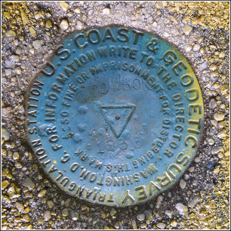
TOWSON (JV5451)
TOWSON
Spatial/elevation data
| Coordinates | N 39.403735° W 76.605396° |
| Elevation | 479 ft. |
| Location | Maryland
Baltimore County Towson Quad |
Mark description
| Type | Triangulation Station Disk |
| Setting | Round Concrete Monument |
| Monumented | 1933 by NGS |
| Description (NGS) | NGS Datasheet |
NGS recovery information
Descriptive text
Station recovered in good condition as described in the 2011 recovery note. Reference marks were not searched for at this time. Note: the station is on the property of the Immaculate Conception School. Please notify school officials before recovering or using this station.Narrative and photographs
I had time for a few benchmark hunts in Towson before meeting up with Kristen for supper. My first goal was the eponymous TOWSON, which appeared to be near a Catholic school near the center of town. As I approached the Immaculate Conception School, the humidity in the air became somehow even more oppressive than it had been all day, and the rain began.
Fortunately I could see the monument from the street. I wasn’t sure whether to ask for permission to complete the recovery—it wasn’t clear that the monument was actually on the school’s property, there wasn’t much activity around the school, and it was already nearly 6:00pm.
While I was fumbling with the datasheets, camera, and umbrella, and trying to keep everything dry, a woman approached me to ask who I was and what I was doing there. She was concerned because no one at the school recognized me as a parent of any of their students. I apologized and told her that I expected the students would be gone since it was already so late in the day.
The woman was very kind and understanding, and she explained that they have an extended-length school day for whatever reason. She also seemed interested in the concept of survey marks. She liked the idea of showing the students the mark, explaining its use and history, and also using the description to demonstrate how much the area has changed over the years. I gave her my copy of the datasheets and added my contact information.
Due to limited time, I did not search for the reference marks. It seems likely that RM 3 is gone, as it was embedded in the concrete footer of the water tank at this location, which was removed years ago. RM 1 may still be in place in the woods nearby, but the area is infested with poison ivy. RM 2, which is also the azimuth mark, is significantly further north on York Road (now MD Route 45).


