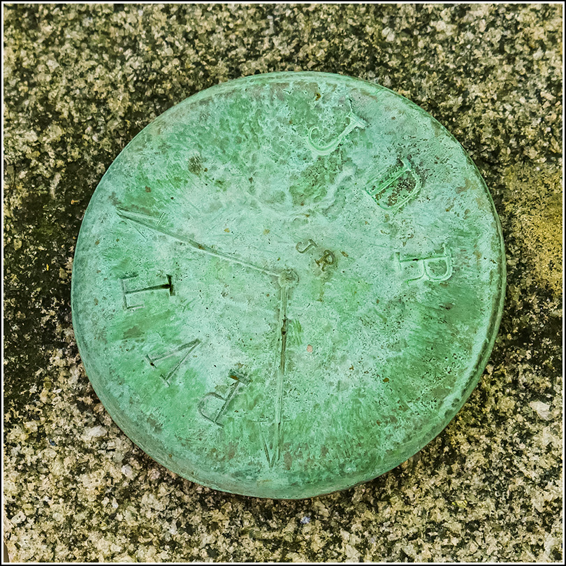
JDR/PVT
JDR/PVT
Recovered in Good Condition on September 9, 2019
Spatial/elevation data
| Coordinates | N 44.384083° W 68.227444° |
| Elevation | Unknown |
| Location | Maine
Hancock County Bar Harbor Quad |
Mark description
| Type | Boundary Monument |
| Setting | Granite Post |
| Monumented | Unknown by Unknown Agency |
Narrative and photographs
This is one of several boundary markers we found in deep woods while exploring near the old Archbold estate. This one is in somewhat better condition than others nearby. It in unknown whether these posts still mark a true boundary of park land.


