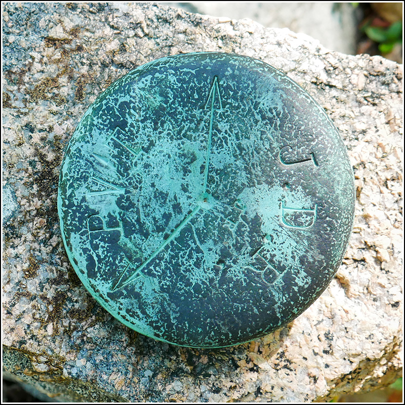
JDR/PVT
JDR/PVT
Recovered in Fair Condition on September 9, 2019
Spatial/elevation data
| Coordinates | N 44.382055° W 68.227805° |
| Elevation | Unknown |
| Location | Maine
Hancock County Bar Harbor Quad |
Mark description
| Type | Boundary Monument |
| Setting | Granite Post |
| Monumented | Unknown by Unknown Agency |
Narrative and photographs
This boundary monument spotted on the abandoned Archbold estate is one of many we’ve found along park boundaries designated JDR/PVT. Today alone, we found four more very similarly stamped monuments on this property and the adjacent property to the north (Barberry Ledge, the old Rowell estate). There are also many stone markers, without disks, on the properties. The disk is in decent condition but the post is leaning at an angle. It appears to be solidly set, and so is probably good enough to indicate the correct historical boundary. (This area now belongs to Acadia National Park.)

