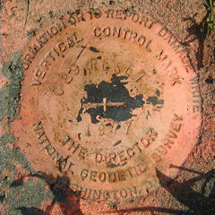
C 29 RESET 1977
Spatial/elevation data
| Coordinates | N 38.544833° W 75.093933° |
| Elevation | 7.5 ft. |
| Location | Delaware
Sussex County Bethany Beach Quad |
Mark description
| Type | Bench Mark Disk |
| Setting | Round Concrete Monument |
| Monumented | 1977 by NGS |
| Description (NGS) | NGS Datasheet |
Narrative and photographs
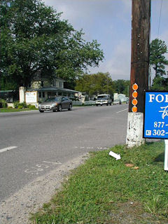
This was the first of six successful recoveries on this beautiful Monday morning in Ocean View. The benchmark disk has been painted orange, which increased its visibility in the thick grass. Also aiding in the recovery were the letters “GPS” and an arrow drawn just south of the mark on the shoulder of Route 26. Both the white frame house and the gum tree are gone; the lot on the northeast corner of the intersection of Route 26 and Woodland Avenue is now empty. “7H” is no longer marked on the powerline pole nearest the benchmark, but the next pole north on Woodland Avenue is labeled “7I”. The mark is in good condition and the stamped designation and date are legible.

